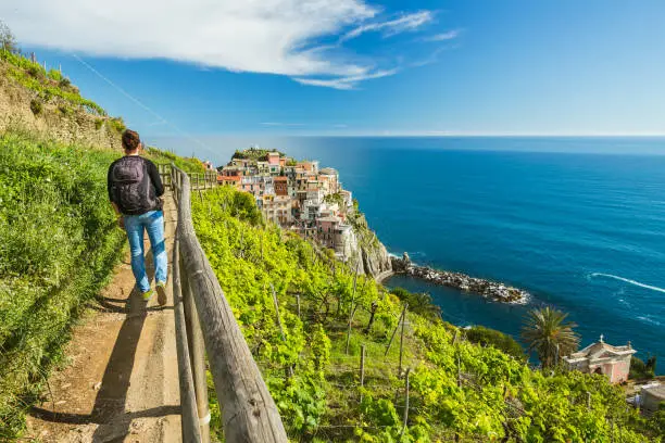
Hiking in Italy offers an unparalleled adventure, If you’re a solo traveler or travelling with your partner and seeking the best hiking experiences in Italy, you’re in the right place! stay tune and let’s travel the wonders of nature together!
Italy’s diverse landscapes and its demography are an absolute fit for hiking enthusiasts. Picture yourself navigating the rugged beauty of the Dolomites or strolling along the scenic trails of Cinque Terre – every step opens up to breathtaking vistas and a rewarding sense of accomplishment.
Also Read: Hiking in Bali Best 10 trails 2023 | Bali Hiking
Best Months for Hiking in Italy
The best time for hiking in Italy depends on the region you plan to explore, as the country experiences diverse climates due to its varied topography. Here are some general guidelines:
- Spring (April to June): Spring is often considered an excellent time for hiking in many regions of Italy. The weather is mild, and nature comes to life with blooming flowers and lush greenery. Trails are not overly crowded, and temperatures are generally comfortable.
- Fall (September to October): Similar to spring, the fall season offers pleasant temperatures, making it a great time for hiking in Italy. The landscapes are often adorned with autumn colors, creating a picturesque setting. Trails are still relatively quiet compared to the summer months.
- Summer (July to August): While summer can be a popular time for hiking in Italy, especially in the higher elevations, it’s essential to consider the heat, especially in southern Italy. In the Alps and Dolomites, higher elevations provide cooler temperatures. However, trails can be more crowded during this time.
- Avoid Extreme Weather: Some regions, especially in the south, can experience extremely hot temperatures in the peak of summer, making hiking uncomfortable. Winter, especially at higher altitudes, can bring snow and challenging conditions.
- Check Local Conditions: Always check local weather conditions, trail accessibility, and any seasonal considerations for the specific region you plan to hike. Some trails may be closed or have restricted access during certain seasons.
Ultimately, the best time for hiking in Italy depends on your preferences and the specific area you want to explore. Consider the climate, trail conditions, and the level of activity you desire for an enjoyable hiking experience in Italy.
Discover the Top 8 Hiking Destinations in Italy
1: The Sella-Herbetet Traverse
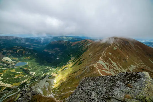
- Length: Approximately 8 or 9 miles (13/14 kilometers)
- Estimated Time: 6-8 hours
Exploring the Sella-Herbetet Traverse appears like entering into a paranormal mountain tale. Picture yourself surrounded by towering Dolomite peaks, developing a majestic backdrop that provides the appeal of your journey. For a most desirable enjoyment, plan your hike all through the overdue spring or early summer season while the meadows burst right into a mix of colorful wildflowers, reworking the landscape right into a vibrant tapestry. The air at some stage in this time is refreshing, carrying the candy-heady scent of blooming flowers.
As you navigate the paths, take moments to rest on a relaxed rock and observe the playful dances of butterflies around you. Listen to the gentle whispers of the wind because it rustles through the leaves. If you appear intently, you would possibly spot a few pleasant flora and fauna, like chirping birds or scampering squirrels. It’s not only a tough journey; it’s a profitable quest that invitations you to come to be a part of the untouched splendor of the Dolomites.
While hiking, sense the earth below your toes, and breathe in the crisp mountain air. The splendor of this hike lies not just in achieving the vacation spot but in appreciating the small wonders along the manner. So, lace up your trekking footwear, embrace the magic of the mountains, and let the Sella-Herbetet Traverse unfold its fairytale before you.
General Information: The Sella-Herbetet Traverse is located in the Dolomites, a mountain range in northern Italy. The specific direction can depend on your starting point, but generally, it is in a northeastern direction from major cities like Trento or Bolzano.
Regarding the distance from the city center, it’s essential to know which city you are starting from, as the Dolomites cover a vast area. Both Trento and Bolzano are common starting points for exploring the Dolomites. To get accurate and up-to-date information, I recommend checking a map or a reliable travel resource for the specific details based on your starting location.
2: Cinque Terre (Sentiero Azzurro)
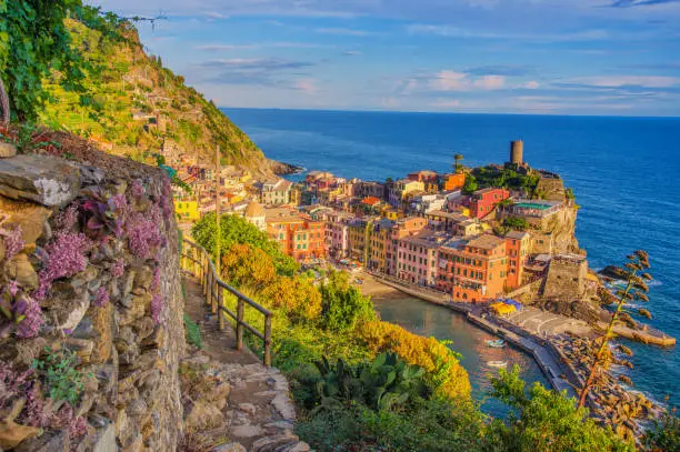
- Length: Around 7.5 miles (12 kilometers)
- Estimated Time: 5-6 hours
As you walk on Cinque Terre’s Sentiero Azzurro, there are many fun things to do. First, try dipping your toes in the refreshing Mediterranean Sea – it’s like having a little foot party! Then, take a break to taste the yummy local gelato while you walk through cute villages. Look at the cliffs; they have the coolest views! Feel the wind in your hair – it’s like nature’s hairdryer. And oh, don’t forget to take lots of pictures of the colorful houses against the blue sky. It’s like capturing a rainbow on land! So, enjoy these cool things while you’re on the hike – it’s like having a super fun adventure with your friends and the beautiful seaside!
General Information: Cinque Terre, including the Sentiero Azzurro trail, is located on the northwest coast of Italy, overlooking the Ligurian Sea. The five villages of Cinque Terre (Monterosso al Mare, Vernazza, Corniglia, Manarola, and Riomaggiore) are situated in the region of Liguria.
If you are considering a specific city center as the starting point, it’s common to use La Spezia or Genoa as bases for exploring Cinque Terre. La Spezia is approximately 15 kilometers southeast of Riomaggiore, the southernmost village of Cinque Terre. Genoa, a larger city, is farther away, located to the northwest.
For accurate and up-to-date information, especially regarding the distance from a specific city center, it’s recommended to check a map or use reliable travel resources.
3: Tre Cime di Lavaredo
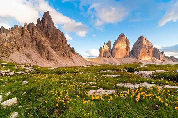
- Length: Approximately 6 miles (10 kilometers)
- Estimated Time: 3-4 hours
Stand in awe as you gaze at the enormous rocks forming Tre Cime di Lavaredo. It’s like a real-life mountain kingdom! Look closely, and you might see mountain goats jumping around the rocky edges – they’re like acrobats of the Alps. Find a cozy spot on the soft grass for a picnic, surrounded by tall mountains.
If you’re lucky, you might even see brave climbers reaching the mountain tops – it’s like watching a real adventure movie! Take a deep breath and enjoy the fresh mountain air; it’s like nature’s own perfume. Let the huge Dolomite mountains make you feel super tiny but part of something really big and amazing.
So, have a fantastic time exploring the magical world of Tre Cime di Lavaredo!
General Information: Tre Cime di Lavaredo is located in the Italian Dolomites, specifically in the Veneto region. The nearest city center often used as a base for exploring Tre Cime di Lavaredo is Cortina d’Ampezzo. Cortina d’Ampezzo is situated in the province of Belluno, Veneto, in the northern part of Italy.
The general direction from Cortina d’Ampezzo to Tre Cime di Lavaredo is north. The distance between Cortina d’Ampezzo and Tre Cime di Lavaredo is approximately 30 kilometers (18.6 miles) by road.
For accurate and up-to-date information, especially regarding the distance from a specific city center, it’s recommended to check a map or use reliable travel resources.
4: Mount Vesuvius – Best Hiking in Italy
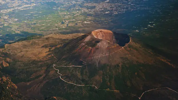
- Length: Around 3 miles (5 kilometers)
- Estimated Time: 2-3 hours
Embark on an interesting journey with the fine hiking in Italy as you overcome the legendary Mount Vesuvius. Imagine being a brave explorer, walking up the slopes, and discovering the secrets of this ancient volcano.
The first-rate instances to head are in spring or fall whilst the weather is just ideal – no longer too hot, now not too cold. As you climb higher, it’s like moving into a time system, surrounded by way of the stays of powerful volcanic eruptions. You can experience the power that shaped Italy’s land a long time in the past. While hiking, take breaks to experience the beautiful scenery round you. Spot colorful flowers and maybe even a few curious animals.
It’s like having a nature treasure hunt! When you attain the pinnacle, you’ll be rewarded with breathtaking views of the surrounding landscapes and the Bay of Naples. It’s like standing on a massive’s playground!
Bring a picnic to experience on the tender grass, and in case you’re fortunate, you would possibly see birds soaring inside the sky. Feel the cool breeze and concentrate to the sounds of nature – it is like a peaceful symphony.
This hike isn’t just about reaching the summit; it’s approximately experiencing the wonders of the outdoors and discovering the memories hidden inside the rocks.
So, tools up, embody the adventure, and make reminiscences in order to final an entire life while trekking in Italy’s magnificent Mount Vesuvius.
General Information: Mount Vesuvius is located east of Naples, Italy. The direction would be southeast if you are considering Naples as the reference point. The distance from the city center of Naples to Mount Vesuvius is approximately 9 kilometers (about 5.6 miles) in a straight line.
For accurate and up-to-date information, especially regarding the distance from a specific city center, it’s recommended to check a map or use reliable travel resources.
5: Sentiero degli Dei
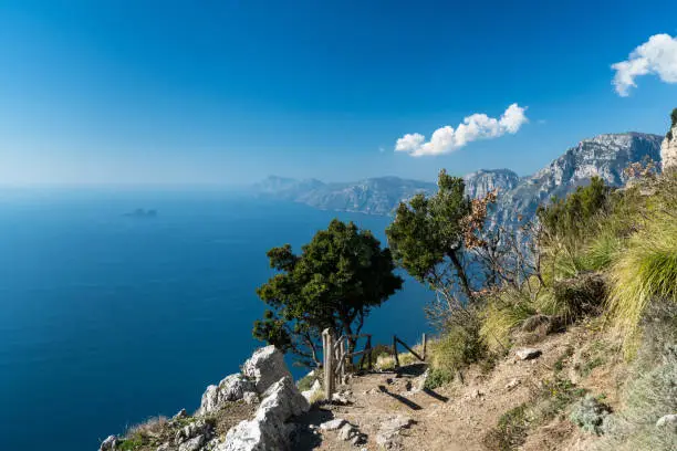
- Length: Approximately 4.5 miles (7 kilometers)
- Estimated Time: 3-4 hours
Imagine taking a magical walk along the “Path of the Gods” on the Amalfi Coast, where every step feels like a dream with amazing views. The best time to go is in late spring or early fall, so you won’t feel too hot in the summer.
As you walk, you’ll find sweet-smelling lemon groves – it’s like being in a place that smells really nice! The views are so fantastic; it’s like looking at a giant painting of the sea and the cliffs. It’s not just a walk; it’s a treat for your senses, where you can smell the lemons, see the stunning scenery, and feel the gentle breeze. So, put on your walking shoes and get ready for a heavenly adventure along the “Path of the Gods.”
- Top of Form
General Information: The “Sentiero degli Dei” or “Path of the Gods” is located on the Amalfi Coast in southern Italy. If you are considering a specific city center as the reference point, popular starting points for this trail include Bomerano in Agerola or Praiano. The direction would generally be southwest if you’re referring to these starting points.
The distance from the city center can vary depending on the specific starting point, but if you’re using a common reference like Amalfi or Positano, it’s approximately 20-30 kilometers away. For accurate and up-to-date information, especially regarding the distance from a specific city center, it’s recommended to check a map or use reliable travel resources.
6: Corno Grande – Best hiking in Italy
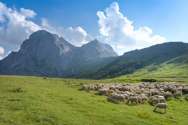
- Length: Around 1.86 miles (3 kilometers)
- Estimated Time: 2-3 hours
Embarking on the journey to Corno Grande in the Apennines is like stepping onto the tallest rooftop in all of Italy. The perfect time for this adventure is in the summer, when the meadows below explode with all kinds of bright colors. Reaching the tippy-top is like accomplishing something really big, and the view from up there is so big and amazing, it feels like flying!
These hikes are not just about moving your body; they’re also about exploring Italy’s different lands. Each trail is like a storybook waiting to be opened, and the best time to open it is when nature is showing off its most enchanting parts. So, put on your hiking shoes, get ready for an adventure, and watch as the beauty of Italy unfolds right in front of you.
While on these hikes, you can enjoy so many cool things. In the summer, the meadows are like a giant painting with flowers of all colors. When you reach the top, the view is like a giant picture of Italy – it’s so big and amazing, you’ll want to take a million pictures! You can also have a picnic on the soft grass and feel the breeze on your face. It’s like having a nature party! So, enjoy the adventure, make some great memories, and discover the best hiking in Italy.
General Information: Most people start their hike to Corno Grande, the highest peak in the Apennine Mountains, from the trailhead at the Campo Imperatore plateau. Campo Imperatore is a large, high-altitude plateau and is a common starting point for ascending Corno Grande.
The exact trail distance can vary depending on the specific route taken, as there are multiple trails leading to the summit. The classic route is the Normal Route (Via Normale), which starts from the Rifugio Duca degli Abruzzi. The approximate trail distance from the Rifugio Duca degli Abruzzi to the summit of Corno Grande is about 3 kilometers (approximately 1.86 miles).
As trail conditions and distances may vary, it’s advisable to check with local guides or park authorities for the most accurate and up-to-date information before beginning the hike.
7. Alta Via: Dolomite Majesty
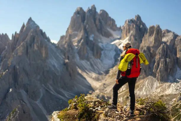
- Length: The Alta Via 1 covers about 120 kilometers, while Alta Via 2 extends for approximately 150 kilometers.
- Time to Complete: Hiking Alta Via 1 usually takes around 8 to 10 days, while Alta Via 2 may require 10 to 12 days, depending on your pace.
- Best Time to Go: Late spring to early fall is ideal, avoiding extreme temperatures
Embarking at the Alta Via trails in Italy’s northern regions is like entering into a fairytale of mountains and meadows. Imagine strolling via fields full of colourful wildflowers, surrounded by means of towering peaks that stand like nature’s guardians. The Alta Via trails are like a playground for hikers who love challenges and stunning landscapes.
As you start your adventure on the Alta Via 1, a classic course unfolds, stretching one hundred twenty kilometers from Dobbiaco to Belluno. It’s like a adventure via enchanted valleys, over alpine meadows, and conquering tall mountain passes. The air is crisp, and the views are so breathtaking; it feels like being in a dream.
For the ones in search of a good extra interesting venture, the Alta Via 2 awaits, supplying a worrying a hundred and fifty-kilometer trek from Bressanone to Feltre. It’s like diving deep into the untamed beauty of the Dolomites, where each step is a discovery and every top is a triumph.
During these hikes, you can enjoy so many fantastic things. In the meadows, you would possibly spot curious animals and spot how many extraordinary plants you could discover. Crossing the mountain passes seems like going on a exciting adventure, and the views from the top are like searching at a massive portray made with the aid of nature. It’s no longer just about taking walks; it is about exploring a mystical global where the mountains end up your playmates. So, placed on your trekking shoes, percent a snack, and get ready for a journey via the spell binding Dolomites on the Alta Via trails.
General Information: The term “Alta Via” refers to a network of high-level hiking trails in the Dolomite mountain range in northern Italy. The specific direction and distance from a city center can vary, as there are multiple Alta Via routes (e.g., Alta Via 1, Alta Via 2). Generally, the Dolomites are situated northeast of major cities like Venice and Verona.
For example:
- Alta Via 1 spans from Dobbiaco to Belluno.
- Alta Via 2 covers a route from Bressanone to Feltre.
The distance from city centers depends on the specific starting and ending points of the chosen Alta Via route. Travelers often access the Dolomites from cities like Venice or Verona and then proceed to the trailheads. For accurate and up-to-date information, it’s recommended to check maps or consult local resources.
8. Stromboli: Dancing with Fire
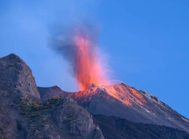
- Length: The Stromboli hike is around 3 kilometers round trip.
- Time to Complete: A night hike to witness eruptions takes about 3 to 4 hours.
- Best Time to Go: Opt for the summer months. Or embarked on this adventure in August, feel the warmth of the volcanic glow on your face. Standing on Stromboli, watching fiery displays against the night sky, was a dance with nature’s fireworks.
Discover the amazing Aeolian Islands and go on an exciting hike up Stromboli, the best hiking spot in Italy! This volcano View offers you a tremendous cool journey if you want being out of doors. While hiking, you would possibly see the volcano doing tiny eruptions, making it look magical next to the Tyrrhenian Sea.
For an even more fun time, try hiking Stromboli at night. Imagine the sky getting bright with bursts of hot, glowing lava – it’s like a magic show! Stromboli is one of the best options for those who enjoy thrilling hikes and want to stay safe with friendly guides. Prepare for an adventure surrounded by the beauty of nature and incredible views of the volcano!
While hiking Stromboli, you can enjoy looking at pretty flowers and special birds on the way. Feel the nice sea breeze and take breaks to see cool views of other islands. Listen to the waves hitting the shore for a calm feeling.
As you follow the steps, you can discover how the island formed and why the volcano does cool stuff. Learn how plants can grow in the special soil, and you might even spot nice lizards or colorful butterflies on your journey!
Stromboli is not just a big hill; it’s a lively part of our world waiting for you to explore. Whether you like walking on the rocks or just roaming around nature, Stromboli has a lot to show you. Deep dive into the best hiking in Italy and enjoy exploring Stromboli!
General Information: The hike to the summit of Stromboli, often referred to as “Dancing with Fire,” typically starts from the town of Stromboli on the island of the same name. The exact trail distance can vary depending on the specific route taken, but the most common path is approximately 3 kilometers (about 1.86 miles).
The time to complete the hike can also vary based on factors such as individual fitness, weather conditions, and the chosen trail. On average, it takes about 3 to 4 hours to ascend from the town to the summit and back. However, this is a general estimate, and hikers should be prepared for changes in trail conditions and possible delays.
It’s crucial to note that hiking Stromboli involves ascending an active volcano, and the trail may be closed at times due to volcanic activity. Always check with local authorities or guides for the latest information on trail conditions, and adhere to safety guidelines when hiking in this unique and dynamic environment.
Final Reflections
As you wander via Italy’s mountains, allow the fresh breeze touch your face, and take within the splendor of vibrant flora within the spring. Exploring locations like Cinque Terre seems like locating hidden treasures with each step. The Renaissance Ramble trail isn’t only a walk; it is a journey that whispers testimonies of Italy’s beyond.
Think about folks that walked those paths earlier than you, and consider the stories woven into the landscapes. Italy’s trails are more than nature; they’re a connection to history and the shared human enjoy. So, to your hike, have fun with every second, deal with nature kindly, and embrace the specific contact that makes every step significant.
Also Read: Valley of the Five Lakes Best Hiking 2023
FAQ about Hiking in Italy
What are the best months for hiking in Italy?
Spring (April to June) and fall (September to October) are generally considered the best months for hiking in Italy. The weather is mild, and the landscapes are vibrant during these seasons.
What should I pack for a hiking trip in Italy?
Essential items include comfortable hiking shoes, weather-appropriate clothing, a hat, sunscreen, a water bottle, a map, and a first aid kit. Depending on the season and location, additional gear may be necessary.
Are the hiking trails in Italy well-marked?
Many popular hiking trails in Italy are well-marked, especially in tourist-frequented areas. However, it's advisable to carry a map or use GPS, especially in less-traveled regions.

Meet Vikash Sajwal, the driving force behind vikatraveller. With a wealth of experience in both the travel and SEO industries, Vikash seamlessly combines his passion for exploring the globe with his expertise in digital marketing. Having embarked on adventures across borders, he brings an international perspective to his travel tales.
